


Private proof

Wild Latitude

A private website proof prepared by Nine10 Marketing. Sign in to view.

We couldn’t verify that. Check the username and password.
© 2026 Nine10 Marketing · Confidential preview
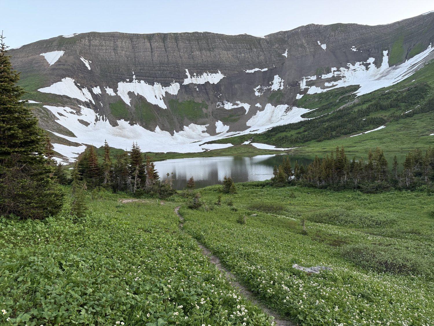
Windfall Lake below its snow-streaked headwall in the Tumbler Ridge UNESCO Global Geopark

Northeastern British Columbia: Tumbler Ridge adventures and trip planning

Tumbler Ridge is our anchor: Western Canada’s only UNESCO Global Geopark, with waterfalls, dinosaur trackways, and alpine lakes close enough for a weekend and wild enough to feel a long way from anywhere.

Wild Latitude with Stacie and Ryan Visit Tumbler Ridge Tumbler Ridge UNESCO Global Geopark Tumbler Ridge Outdoor Recreation Association Northeast BC
Adventure Guides

Northeastern BC Adventure Guides

Every trip we take in northeastern British Columbia gets its own guide: how to get there, the route, where to camp, what to know before you go, maps and official resources, and our own photos and film. Newest first.

Tumbler Ridge · British Columbia New

Windfall Lake Trail

An alpine lake in a limestone cirque in the Tumbler Ridge UNESCO Global Geopark, a backcountry camp under the headwall, and the Circular Route back over the alpine.

  • 10 km return
  • 414 m gain
  • Challenging
  • Hiking
  • Backpacking
  • Camping
  • Lake
  • Forest
  • Meadow / wildflowers
  • Geology & fossils
Read the Windfall Lake Trail guide Our trip: July 2026 · Added September 2026
Coming next
  • Mount SpiekerTumbler Ridge

See every Alberta and BC adventure guide →

Getting There

How to Get to Tumbler Ridge, BC

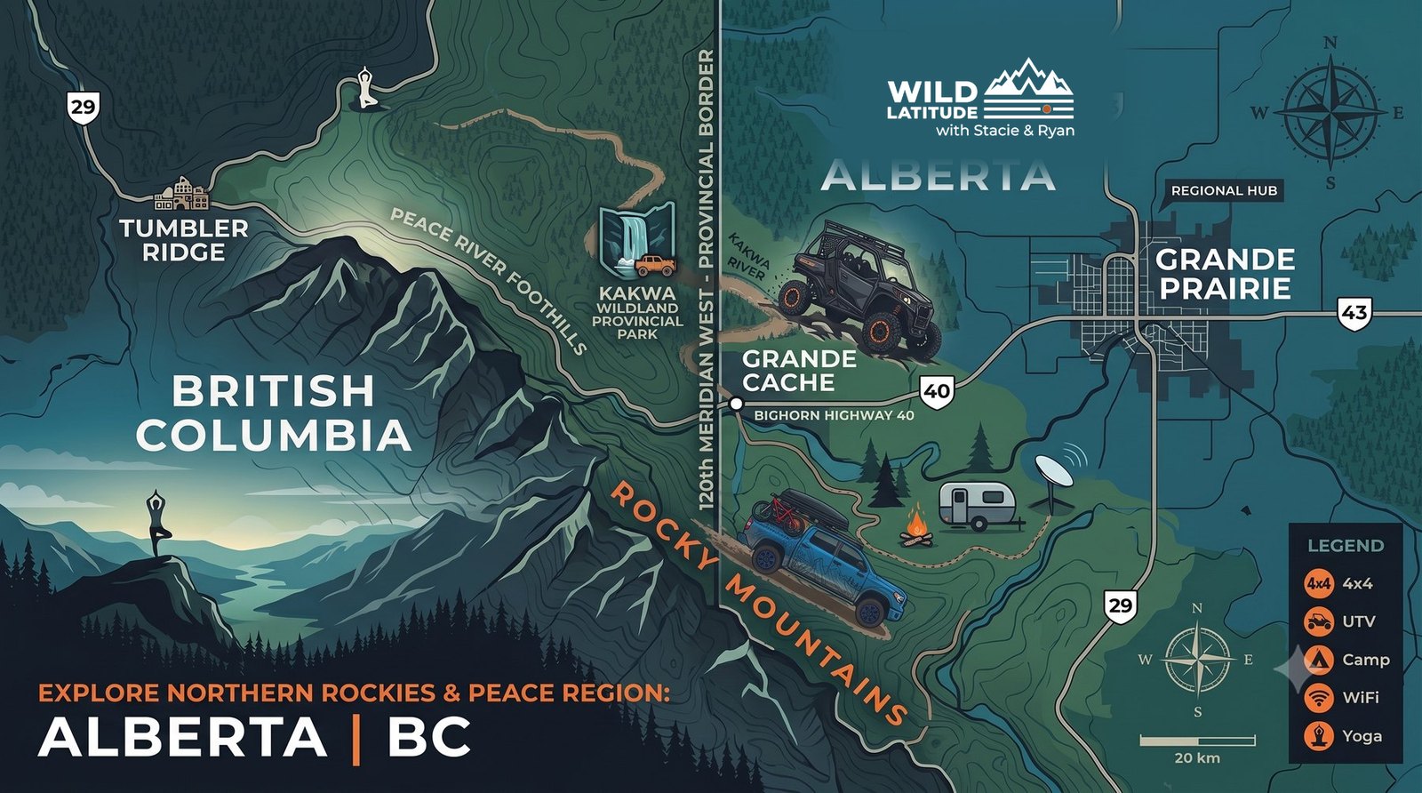
Tumbler Ridge is 250 km from Grande Prairie, 117 km from Dawson Creek, and 92 km from Chetwynd. You reach it on Highway 52 from Dawson Creek or Highway 29 from Chetwynd. Highway 52 East from Alberta is partly gravel.

GPS can send you down poorly maintained forest service roads, especially in winter, so stick to the highways and check DriveBC before you leave. The nearest scheduled flights land in Dawson Creek, Fort St. John, Prince George, and Grande Prairie.

Getting Here: Visit Tumbler Ridge DriveBC Road Conditions

Source: Visit Tumbler Ridge, Getting Here.

Where We Roam Grande Prairie → Tumbler Ridge
Map of the Wild Latitude region showing Tumbler Ridge and northeastern British Columbia next to Grande Prairie and northwestern Alberta
Tumbler Ridge

Tumbler Ridge UNESCO Global Geopark

The Tumbler Ridge UNESCO Global Geopark covers 8,478 square kilometres from the Alberta border to the Sukunka Valley: world-class dinosaur trackways and fossils, spectacular waterfalls, and trail networks that run from easy walks to full alpine routes.

A UNESCO Global Geopark since 2015, it holds 34 geosites and the Dinosaur Discovery Gallery in town. A coal town in the 1980s, Tumbler Ridge rebuilt itself into one of the best backcountry bases in the province. Our first overnight trip, Windfall Lake, was shot here, and the town is the anchor for everything we do on the BC side.

Read the Windfall Lake Guide

Sources: UNESCO, Visit Tumbler Ridge, District of Tumbler Ridge.

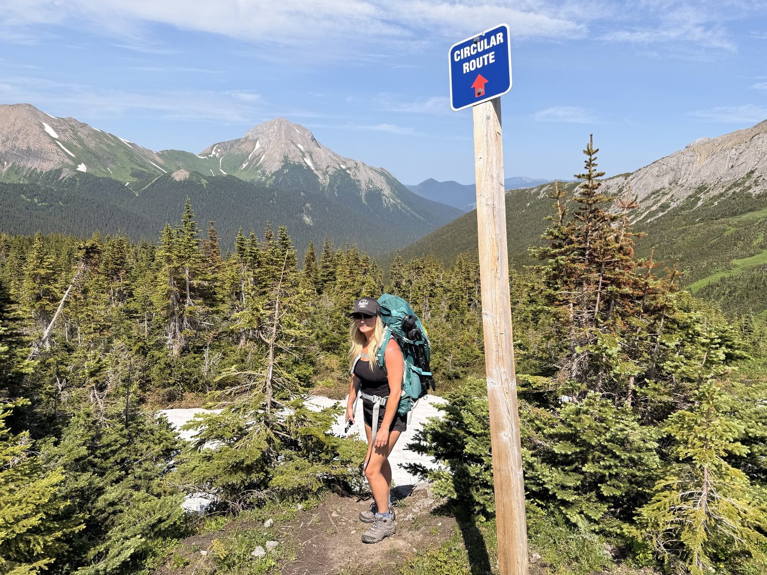
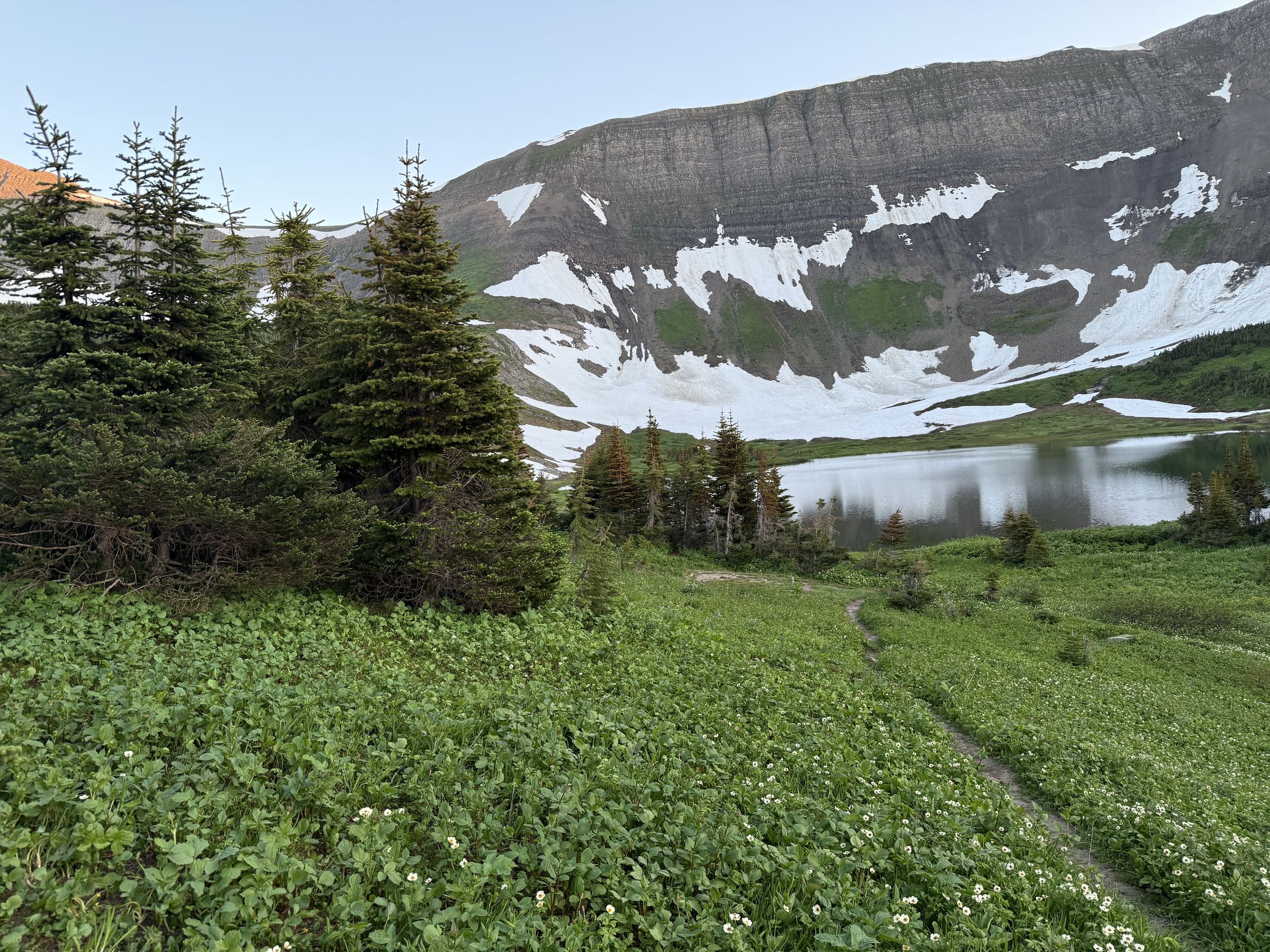
A trail marker on a Tumbler Ridge UNESCO Global Geopark route with the valley and mountains behind
Where We Point the Rig

Tumbler Ridge Hikes, Waterfalls, and Dinosaur Trackways

The highlights around Tumbler Ridge. Open a stop for the short version; the ones with a guide link to the full write-up.

Windfall LakeAdventure guide
10 km return · 414 m gain · challenging

An alpine lake in a limestone cirque with a backcountry campsite under the headwall. Read our Windfall Lake guide →

Kinuseo FallsMonkman Provincial Park
60 m · taller than Niagara

About 65 km south of town by road: 14 km on Highway 52 East, then 51 km of rough gravel on Kinuseo Falls Road. BC Parks runs a 42-site campground. The road is not open to vehicles in winter.

Bergeron FallsWNMS trail
100 m drop · 9 km return · 3 to 4 hours

A 100 m waterfall, 9 km return to the top of the falls with 170 m of gain. The circular route is 12 km return with 450 m of gain, 5 to 7 hours.

Quality FallsEasy
2.5 km return · 1 to 2 hours

A short, easy walk to a waterfall and canyon close to town. A good first outing on arrival day.

Mount SpiekerAlpine ridge
1,971 m summit · moderate · 3 to 4 hours

Alpine routes, not built trails, from a trailhead up the Wolverine Forest Service Road. Wildflowers peak in July and August. Expect wind and fog, carry a radio for the industrial road, and know you are in grizzly country.

Dinosaur Trackways & MuseumTumbler Ridge Museum
Guided trackway tours · 300 million years

The Tumbler Ridge Museum Foundation runs guided tours to the Flatbed Creek and Wolverine River trackways. The Dinosaur Discovery Gallery in town covers more than 300 million years, including the world’s only known tyrannosaur trackways.

Sources: BC Parks, Monkman Park, Visit Tumbler Ridge (Kinuseo Falls, Bergeron Falls, Quality Falls, Mount Spieker, the museum), WNMS and the Tumbler Ridge Museum Foundation.

A trail marker on a Tumbler Ridge UNESCO Global Geopark route with the valley and mountains behind
On the trail in the Tumbler Ridge Geopark
The Great Wilderness

Northeast BC’s Big Five Adventures

Northeast BC Tourism’s Big Five frames the region around five signature adventures. Tumbler Ridge is ours to start with; the rest are on the list.

01

Tumbler Ridge Geopark

Western Canada’s only UNESCO Global Geopark, and where our BC season starts.

02

Liard River Hot Springs

Canada’s largest natural hot springs, up the Alaska Highway.

03

Muskwa-Kechika

One of the largest tracts of wilderness south of the 60th parallel.

04

Ancient Forest

The world’s only inland temperate rainforest.

05

The Alaska Highway

The historic route north, and the spine that ties the region together.

Windfall Lake Trail Guide

Windfall Lake, Tumbler Ridge: the hike, the cirque, and a night under the headwall.

Plan a Trip

Backcountry Rules for Northeastern BC

The essentials we sort before every BC trip, each linked to the official source.

Before You Leave Town

Check Conditions Around Tumbler Ridge

Our Partners

Our Northeastern BC Tourism Partners

We’re proud to promote northeastern BC alongside the people who run it. These are the organizations behind the trails, the Geopark, and the visitor services we rely on, and where most of our itineraries start.

Local Resources

Tumbler Ridge Trail and Museum Resources

Not partners, but local groups we rely on when we plan: the volunteers who build the trails and the foundation behind the dinosaur tours. We link to them as resources.

Get Out There

Plan Your Trip to Tumbler Ridge

The Geopark starts at the edge of town. Pick a guide, check the rules, and go.

Adventure Guides
Icon key

Trip Type Icons

Every adventure guide is tagged with the kind of trip it is.

Our trip what we did Also popular here what the area is known for, with a source

Icons used on this page are highlighted: solid for our trips, outlined for also popular here.

How you get there

  • Hiking
  • Backpacking
  • Side-by-side / UTV
  • ATV / quad
  • Overlanding
  • Scenic drive
  • Mountain biking
  • Horseback riding
  • Paddling
  • Snowmobiling
  • Nordic skiing / snowshoeing

What you see

  • Summit
  • Lake
  • River
  • Waterfall
  • Canyon
  • Valley
  • Forest
  • Meadow / wildflowers
  • Cave
  • Dunes
  • Viewpoint
  • Northern lights

What else is there

  • Camping
  • Hot springs
  • Geology & fossils
  • Dinosaur tracks
  • Heritage & history
  • Wildlife
  • Fishing
  • Winter
  • Day trip
Compass: a guide we have planned but not published yet